Airborne Remote Sensing Shows Promise For Highway Data Collection
Posted: Jun 1, 2019
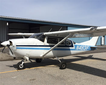
 An airborne remote sensing method called LiDAR (light detection and ranging) is a promising method for collecting data on highway assets such as bridges and culverts, according to MPC research at Utah State University.
The researchers found that airborne LiDAR is much faster in data collection than conventional surveying methods. This study further demonstrated that the point density of airborne LiDAR data is sufficient for most highway assets. In addition, the different perspective provided by airborne LiDAR can detect objects like bridges and culverts that may have been hidden from a ground-based mobile platform. In addition, the data processing procedure proposed in this study improves the efficiency of airborne LiDAR.
The findings of this research can be used as a reference for state DOTs to choose proper methodologies to collect highway inventory data. Also, the LiDAR-data-based method may provide a stepping-stone for future researchers to develop more effective and efficient methods for highway assets detection.
Ziqi Song, Ph.D
Utah State University
Implementation of Aerial LiDAR Technology to Update Highway Feature Inventory
MPC-18-356